-
图文详情
-
产品属性
-
相关推荐
品牌:佳明(GARMIN)
产地:美国
型号:GPSMAP720/720s
简介:
GPSMAP 720:支持雷达
GPSMAP 720s:支持雷达、支持渔探
硬件和性能:
尺寸,长x宽x高: | 8.8" x 5.6" x 3.1" (22.4 x 14.2 x 7.9 cm) |
显示屏尺寸,长x宽: | 6.0" x 3.6", 7.0" diagonal (15.2 x 9.1 cm, 17.8 cm diagonal) |
分辨率,长x宽: | 800 x 480 pixels |
显示类型: | WVGA display |
重量: | 2.48 lb (1.1 kg) |
电池: | none |
电池使用时间: | none |
防水: | 是(IPX7) |
高灵敏度接收机: | 有 |
天线: | internal |
NMEA输入/输出: | NMEA 0183 compatible and NMEA 2000® certified |
Power consumption: | 0.6A at 12V; 0.3A at 24V |
地图和内存:
地图和内存: |
|
电子底图: | 有 |
预装地图: | yes (c沿海海图) |
可附加地图: | 有 |
内置存储器: | none (不能将地图装入内存) |
支持存储卡: | SD™卡插槽 |
航点/收藏夹/位置: | 3,000 |
航线: | 100 |
航迹记录: | 20,000点; 50条航线 |
特征:
兼容Garmin雷达: | 有 |
兼容Garmin声纳: | 无 |
兼容Garmin Marine Network™: | 无 |
触摸屏: | 有 |
支持AIS(跟踪目标船的位置): | 有 |
支持DSC(显示带有DSC的VHF无线电的位置数据): | 有 |
声音报警: | 有 |
潮汐表: | 有 |
打猎钓鱼日程: | 无 |
太阳月亮信息: | 有 |
三维地图视角: | 是(可选BlueChart g2 Vision海图卡) |
自动引导: | 是(可选BlueChart g2 Vision海图卡) |
兼容美国XM WX天气预报无线电: | 有 |
建议路线规划: | 无 |
语音播报(例如,前方500米右转): | 无 |
语音播报路名(例如,前方500米右转到霄云路): | 无 |
耳麦/音频输出: | 无 |
音频/视频输入/输出: | 无 |
可便携的: | 无 |
适用于汽车/摩托车: | 无 |
英文介绍:
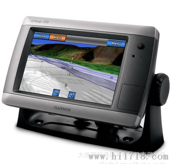
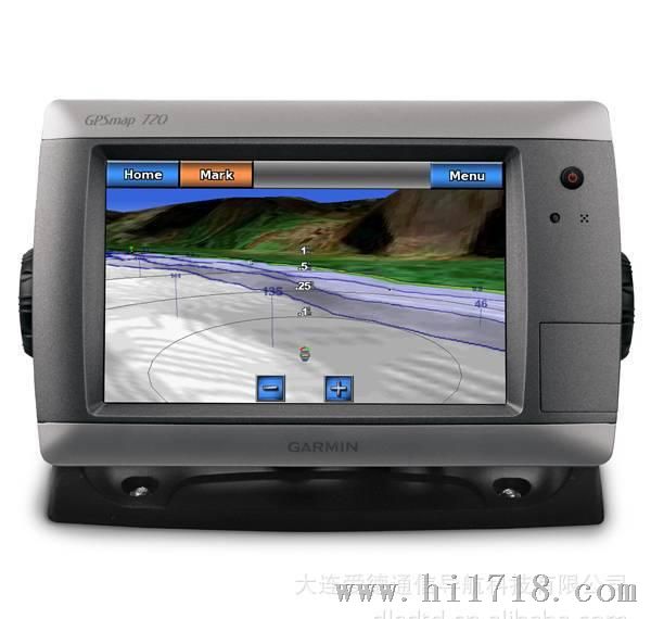
GPSMAP 720 is a stand-alone touchscreen chartplotter that brings a new level of functionality to your vessel. Featuring a brilliant 7-inch display, GPSMAP 720 puts all the information you need right at your fingertips. GPSMAP 720 is preloaded with a worldwide basemap and accepts additional map data for greater flexibility. In addition, GPSMAP 720 accepts radar input and offers full NMEA 2000® connectivity for greater convenience when adding extra sensors.
View Worldwide Basemap
GPSMAP 720 comes with a worldwide basemap and features an internal, high-sensitivity GPS receiver for superior satellite tracking and quicker acquisition times. And as an added benefit, GPSMAP 720 can receive graphical weather data for North America through the optional GXM™ 51 satellite receiver/antenna.
Take Control by Touch
Input is easy with GPSMAP 720. Whether you're changing course or simply reviewing information in front of you, the intuitive touchscreen interface makes for simple operation. The device also offers flexible brightness levels for daytime readability along with low-light dimming during night use. And with a widescreen display that?s rugged and waterproof, it's made to perform in any situation.
Expand with Radar
Featuring a built-in radar port, GPSMAP 720 can be interfaced with Garmin's line of affordable GMR™ marine radar systems. Whether you're adding radar now or in the future, you'll enjoy the convenience of "plug-and-play installation" as well as the power, range and high-definition targeting of our proven radar offerings.¹
Add Sonar with GPSMAP 720s
GPSMAP 720s comes standard with a 1kW-capable sonar transceiver. This powerful sonar can help you define fish targets and underwater structures as far down as 2,000 feet when used with a 1kW transducer.²
Add Extras with BlueChart g2 Vision
With the optional BlueChart® g2 Vision SD™ card, you can add a whole new dimension of exceptional features to your chartplotter.
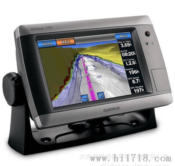
- MarinerEye view and FishEye view provide a 3-dimensional perspective of map information, both above and below the waterline.
- High-resolution satellite images and aerial photographs help you orient yourself in unfamiliar areas.
- Auto Guidance technology searches through all relevant charts to create a route you can actually follow - one that avoids obstacles, shallow water, buoys and other obstructions.
¹Garmin Marine Network not supported.
²Depth capacity is dependent on water salinity, bottom type and other water conditions (with 1 kW transducer).


